Maps
We have included several different maps in order to make your experience in Iroquois Falls memorable. Whether you are a first time visitor or a long-time resident, our maps were created for you. Find everything you need with a simple click.
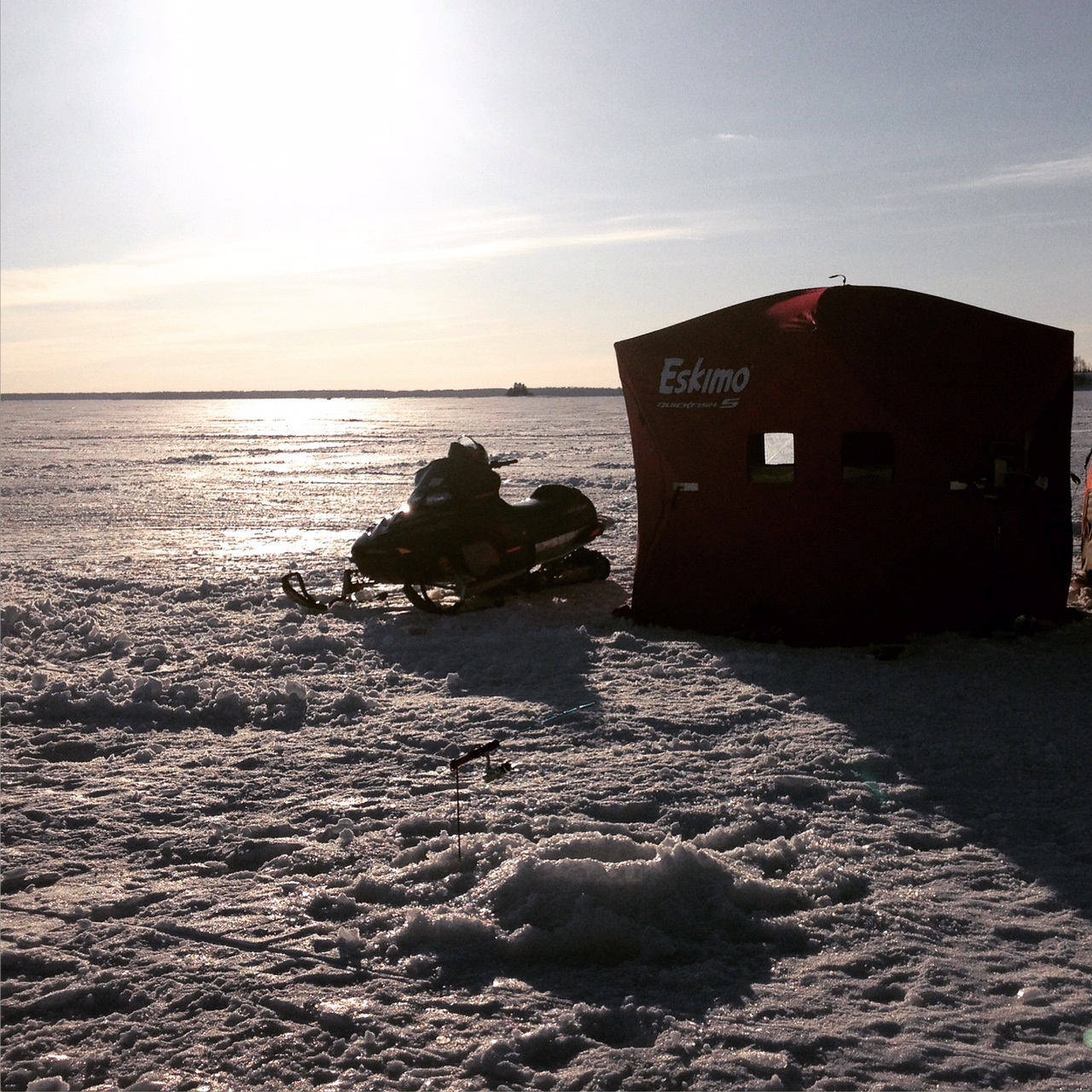
To our visitors: please feel free to print our maps as they will be useful as you get to know our town (the town walking map and area map will be especially helpful). If you are looking to fish or hunt, our CGIS (Community Geographic Information System) may be of use to you, as you are able to see the surrounding areas, rivers and forests. If you are a snowmobiler, the snowmobile maps are a must!
To our new residents: The CGIS (Community Geographic Information System) will be of use to you as it lists garbage pickup dates, zoning, businesses, surplus properties…etc.
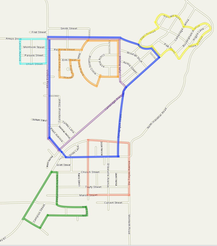
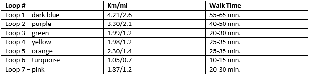
To our residents & visitors: the map of town walking routes is a great resource if you enjoy walking in a beautiful area. The map is divided into popular “loops” and each one is listed along with its kilometres/miles and walk time in minutes.
We hope that these are a helpful resource to you. If you have any questions or concerns, please do not hesitate to contact the Town Hall from Monday-Friday from 8:30 a.m. to 12:00 p.m. and 1:00 p.m. to 4:30 p.m.
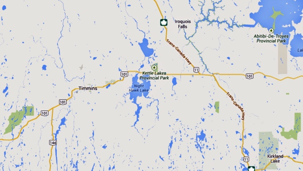
Area Map
The Town of Iroquois Falls lies just off of Hwy 11 on the banks of the Abitibi River, west of Lake Abitibi, 670 km (420 miles) north of Toronto and 250 km (150 miles) south of James Bay. Timmins, one of the largest cities in Northern Ontario is approximately 70 km (50 miles) to the west.
Town Walking Map
Snowmobile Maps
CGIS Map
To be directed to our CGIS map, please click here.
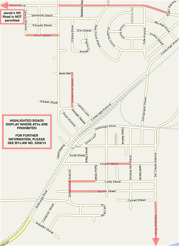
ATV Map
Please review ATV Map for prohibited roads.